


Mon, Jul 10th, 2023 - 12:38pm
May 05, 2023 - 11:15am | By Dean Wysocki
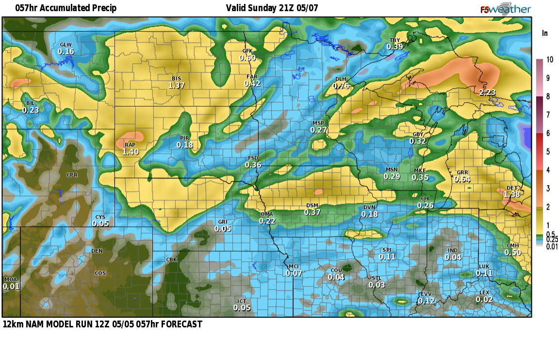
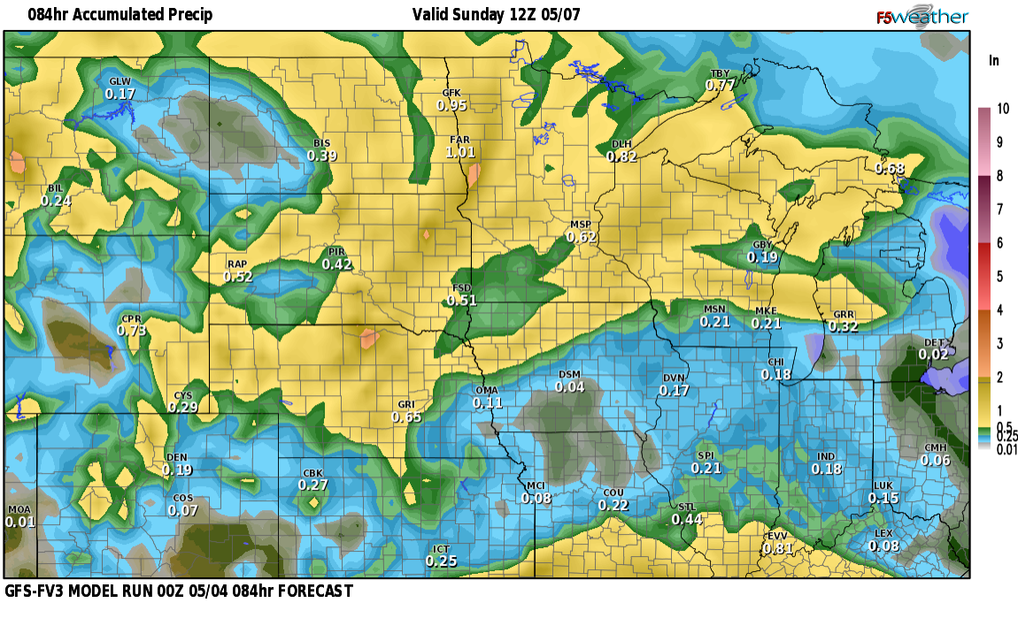
April showers bring may flowers but we had such a late start to the spring (again) that we now have to look forward to May showers. We are going into the "stormy" part of the LRC cycle over the next 10 days. What does that mean? More rain and maybe our first round of severe weather by late next week? It looks like most of the severe weather should remain west and south but we will be tracking it. I've attached a few maps of rainfall through Sunday. As you can see, most of us will see some rain. .50" to 1" is likely from the Valley westward with lesser amounts into lakes country. The ECMWF and GFS models have 1+" in the valley. This IS possible but the more likely scenario is the heavier rain stays to the WEST of the valley. More rain on tap for later next week. This is decent news for ag as long as we don't get it all at once, which doesn't look likely. Enjoy some nice spring rains along with some thunderstorms mixed in.
Chief Meteorologist,
Dean Wysocki


