TODAY is likely the start of this years LRC....the pattern typically resets on Oct. 6th. As we begin this year’s LRC, we have a cold front advancing south on what may end up being LRC Cycle 1 day 1. If you are not familiar with the LRC, it is a forecasting technique that uses a "cycling" pattern to predict long term forecasts. I've had quite a few people ask me "why don't more meteorologist's use this technique?" The answer is easy, not many KNOW how to use it!!! It's not an EASY way to forecast and there are many things you have to factor in when forecasting using the LRC.
Look at the BIG difference between the start of last year's LRC compared to THIS YEAR!!! It's a brand new pattern to start off the new LRC cycle. Now, will it stay this way with a "blocking ridge" in the western U.S. or will we translate into a stormier pattern late Oct. into November?? Let's see how it unfolds over the next month or so. We could have a "split" outcome with a ridge dominating the west, then a stormy pattern following?
If the ridge is the dominate feature for this first cycle of the LRC, look for a warm west and COLD central and eastern US with numerous clippers for the upcoming winter. It's a fascinating pattern to see unfold.
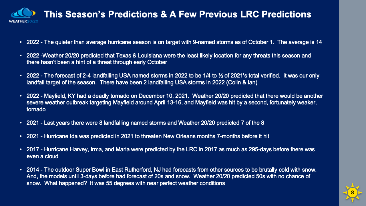
I've also attached how ACCURATE the LRC is at predicting long range forecasts.
If you have any questions, feel free to contact me at weather![]() flagfamily [dot] com
flagfamily [dot] com
Chief Meteorologist,
Dean Wysocki