Mon, Mar 20th, 2023 - 11:04am
April 11, 2021 - 11:05am | By Justin Storm

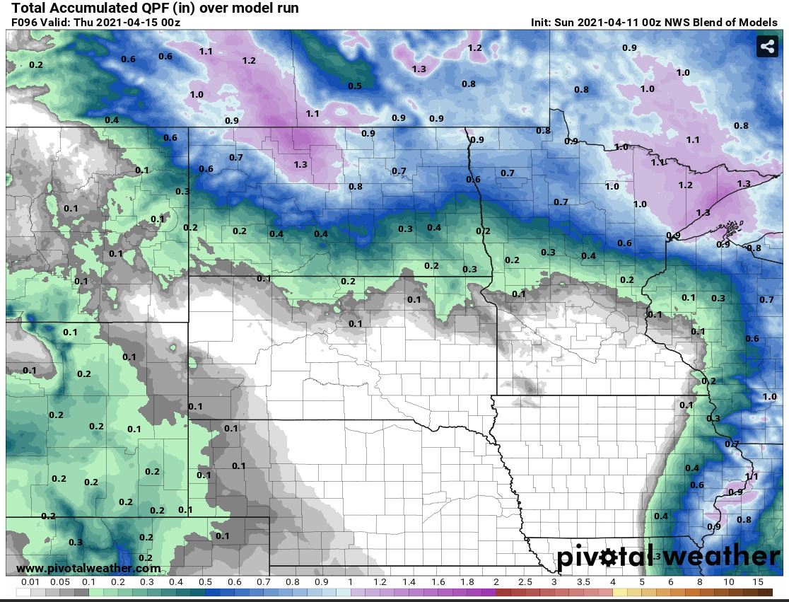
An upper-level system continues to dig into ND bringing a line of precipitation across western North Dakota. That line of precipitation will propagate eastward along a frontal-genetic zone but will mostly affect wester and central ND today/tonight. Within the valley, clouds will increase with scattered showers pushing in from the east. These scattered rain showers will persist overnight and turn over to snow/wintery-mix overnight throughout the area going into Monday. A combination of rain and snow is expected throughout the day of Monday. Temperatures at the surface will remain above freezing in eastern and southern ND however, temperatures aloft will be cold enough to support snow. The main concern is... will the shallow depth of warm air at the surface be enough to melt the snow into rain. I lean towards yes... but only for a short amount of time. Rain/wintery-mix will turn over completely to snow throughout the day and snow showers will continue through the evening and overnight and persist through Tuesday night for much of our region.
Snow totals will be hard to calculate accurately due to the compacting of wet snow, as well as the melting of snow at the surface due to the ground no longer being frozen. Regardless of snow depth, it will melt quickly within a couple of days, and much of the state will get a good well-needed drink of water! :D Throughout the F/M area should see 1-3 inches of snow with more accumulation to the north and northwest.
Top image: NBM 10:1 Snow ratio accumulation (inches)
Bottom image: NBM total QPF liquid water Accumulation (inches)
Meteorologist,
Justin Storm