


Thu, Apr 1st, 2021 - 8:30am
April 07, 2021 - 6:43am | By Dean Wysocki
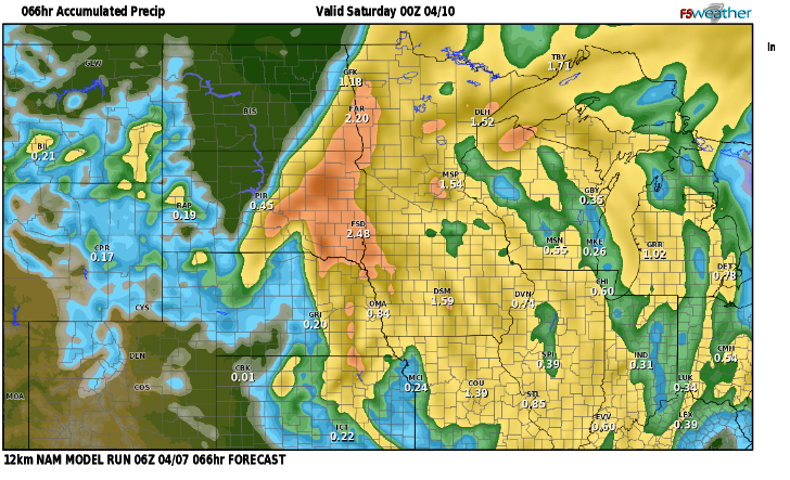
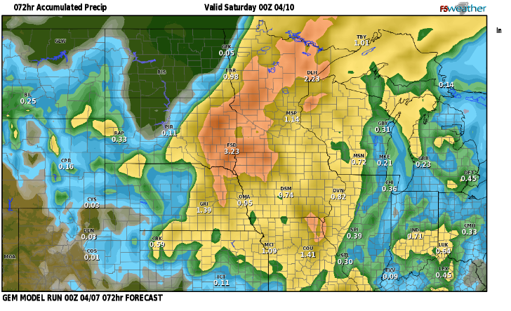
I've attached 3 different computer models of rainfall projections. Notice the vast difference from .25" to around 2" That's a HUGE difference. Where is reality with these models? More than likely somewhere in between. The problem is we have a NE wind flow and that is trying to drag in drier air from the NE into this storm. There will be a sharp cutoff in the precip with the northern valley receiving nothing and areas to our west receiving no rain as well. I believe around the F/M area we should pick up around 3/4 to 1" of rain through friday with much more for the southern valley and into W. Minnesota. Any rain is definitely welcome. Another storm will bring a rain/snow mix to much of the state early next week with chilly temps in the 40s. Are you looking for a nice weekend? Saturday looks to be the best day with temps in the upper 50s to around 60.
Chief Meteorologist
Dean Wysocki


