


Mon, Apr 5th, 2021 - 7:18am
April 02, 2021 - 7:37am | By Dean Wysocki
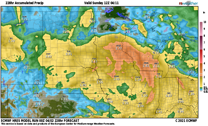
WINDY conditions continue for Friday but Easter weekend looks like winds will be MUCH lighter as high pressure moves in. Then, our attention turns to next week as a storm system will roll off the Pacific and into the plains. Notice the difference in precip between the European and the GFS (American Model) European model carries the heaviest precip into SD and MN while the GFS carries some of the heavier precip into ND which, fingers crossed, would help with our drought conditions. Most of our long term models do carry the heavier precip to our south. However, there looks to be another possible storm around mid month. We really are running short on time in terms of getting the moisture into the valley as drought conditions continue to worsen. I hope everyone has a wonderful and joyous Easter weekend!!
Chief Meteorologist,
Dean Wysocki


