


Tue, May 18th, 2021 - 12:36pm
January 31, 2021 - 1:57pm | By Justin Storm
We are continuing to track snow potential throughout the Red River Valley(RRV) Wednesday into Thursday morning.
As of now, little snow accumulation is expected through the RRV. Most of the region will see between a dusting and 2 inches.
During the beginning of our snow event, it is possible to see some freezing rain/wintery mix.
There are is still time for key components to come together to give us higher snow totals, however not likely.
After the passage of this system going throughout Thursday into Friday, another low will pass through drawing winds out the north northwest pulling down cold arctic air as high pressure builds into our area.
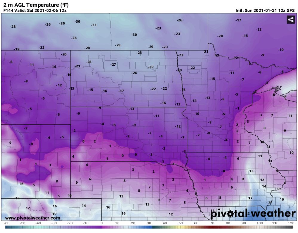
High temperatures through our coming weekend in Fargo/Moorhead will struggle to get above zero.
We will most likely be looking at low temperatures in the 10's to 20's below zero throughout the area, especially under areas of no cloud clover.
Factor in the wind, windchill temperatures could be between -20 to -40, possible even -50 in some spots.
Overnight low temperatures will drastically be dependent on cloud cover. Areas that find themselves under a cozy blanket of clouds won't drop as low as those without cloud cover.
We are continuing to track this arctic air and will continue to keep you updated as our cold weekend gets closer.
Meteorologist,
Justin Storm


